Our watery berth for the overnight, at the very end of an arm in Doubtful Sound, itself on the edge of the world.

Art shows where on the map.
Everyone slept deeply. We convened in the morning for coffee, fruit, and cereals.
Followed mid-morning by a full (English) breakfast: eggs, mushrooms, toast, bangers, bacon, and potatoes.
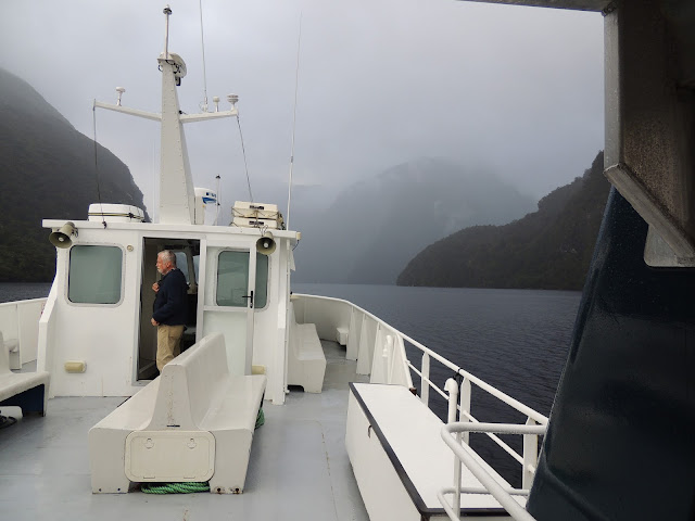
It's a misty, rainy day, but there are advantages. Look at the waterfalls (click here if reading in email to view vid).
There's a powerful solitude here in back and white.
At 421 meters deep (nearly 1400 feet), Doubtful Sound is larger and deeper than Milford Sound.
Here's a quick view from the upper deck (click here if reading in email to view vid).
Doubtful Sound was named 'Doubtful Harbour' in 1770 by Captain Cook, who did not enter the inlet as he was uncertain whether it was navigable under sail.[2] It was later renamed Doubtful Sound by whalers and sealers, although it is not technically a sound but a fiord.
Captain Dave.
A Spanish scientific expedition commanded by Alessandro Malaspina visited Doubtful Sound in February 1793 to conduct experiments measuring the force of gravity using a pendulum, a part of the effort to establish a new metric system.[3] The officers of the expedition, which included Felipe Bauzá y Cañas, a cartographer,[4] also made the first chart of the entrance and lower parts of the Sound, naming features of it. Today these form a unique cluster of the only Spanish names on the map of New Zealand: Febrero Point, Bauza Island and the Nee Islets, Pendulo Reach, and Malaspina Reach.
191 meters, or about 600 feet. Compelling to view the boat's progress and note the depth of the seabed.
Do we look like we need to eat again? Fresh scones with whipped cream and jams were laid before us about an hour before we docked. We were also given bundles of frozen blue cod fillets.
Unforgettable


No comments:
Post a Comment